top of page
Study Area
USGS Geologic Map
DEM of Study Area
Spectral Angle Mapper Classification
Percentage of Classified Pixels
Spectral Unmixing
Spectral Unmixing Over Study Area
Gypsum Spectral Profile Comparison
Spectral Profiles
Spectral Profile with Band Selection
Spectral Unmixing Over Study Area
Final Poster for Group Presentation

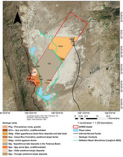
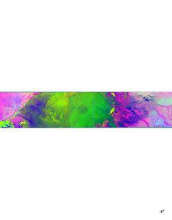
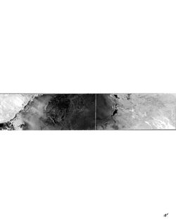
Click on images for descriptions and legend

All images were created from AVIRIS Hyperspectral Data (cited in References)

​

AVIRIS Imaging Sensor

​

224 contiguous bands from 400 –2500 nm


Bands Width = 10 nm wide

Spatial resolution = 20 m at high altitude; 4 m at low altitude
One Scene = 11 km swath x 10 km length 

Orbit Height = ~ 20 km above sea level

Flight Speed = 730 km/hr

SAM Classification Legend

© 2023 by Faber & Co Real Estate. Proudly created with Wix.com

bottom of page