METHODOLOGY
DATA COLLECTION
AVIRIS Data
GIS Geologic Contact Data
CORRECTION
FLAASH Atmospheric Correction
Georeferencing
PROCESSING
Spectral Math
Spectral Angle Mapper and Linear Spectral Unmixing using Supervised Classification
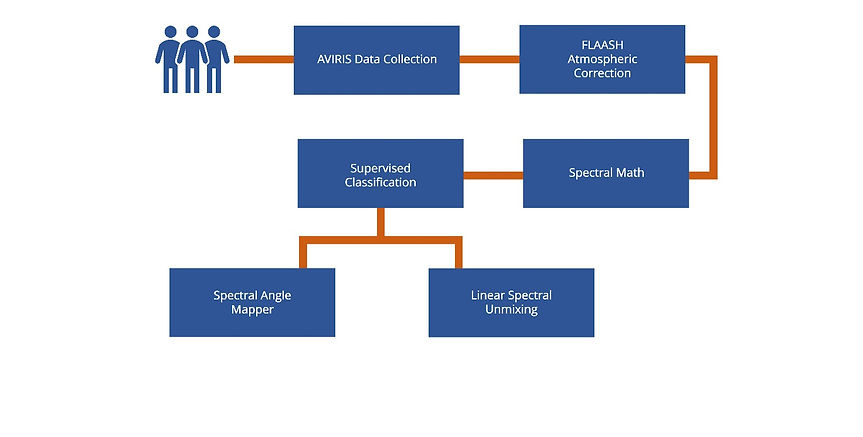
Remote Sensing Methodology
To begin our satellite image analysis, we acquired AVIRIS Data and then processed it through FLAASH Atmospheric Correction to account for any atmospheric defects in the data. This will give us a clean slate to accurately compare ground reflectance to library spectra and determine mineralogy. We then used Spectral Math to convert the FLAASH reflectance values to show a 0 to 1 reflectance. FLAASH scales reflectance values from 0 to 10000, therefore, we divided by 10000. Finally, we used supervised classification method with spectral angle mapper and linear spectral unmixing to compile a geologic map and compare data findings with previously published geologic data and determine provenance of the gypsum sands.
ACQUIRE DATA
Processing Methods
$450/per week
GIS Methodology
To better display our results from remote sensing analysis, we used GIS to geo-reference our findings on top of satellite imagery in order to provide better context and interpretation.
